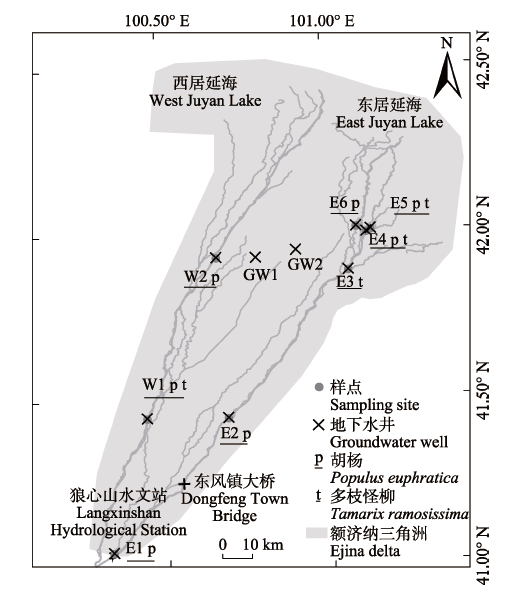
图1. 研究区位置及样点。图中所标示各地点地理坐标如下: 东风镇大桥(100.55° E, 41.25° N), E1 (100.33° E, 41.04° N), E2 (100.69° E, 41.44° N), E3 (101.07° E, 41.88° N), E4 (101.12° E, 41.99° N), E5 (101.14° E, 42.00° N), E6 (101.09° E, 42.01° N), GW1 (100.79° E, 41.92° N), GW2 (100.91° E, 41.94° N), 狼心山水文站(100.32° E, 41.04° N), W1 (100.44° E, 41.44° N), W2 (100.67° E, 41.92° N)。
Fig. 1. Location of the study area and sampling sites. The coordinates of the sites in the figure are as follows: Dongfeng Town Bridge (100.55° E, 41.25° N), E1 (100.33° E, 41.04° N), E2 (100.69° E, 41.44° N), E3 (101.07° E, 41.88° N), E4 (101.12° E, 41.99° N), E5 (101.14° E, 42.00° N), E6 (101.09° E, 42.01° N), GW1 (100.79° E, 41.92° N), GW2 (100.91° E, 41.94° N), Langxinshan Hydrological Station (100.32° E, 41.04° N), W1 (100.44° E, 41.44° N), W2 (100.67° E, 41.92° N).