新一代遥感技术助力生态系统生态学研究
郭庆华*( ),胡天宇,马勤,徐可心,杨秋丽,孙千惠,李玉美,苏艳军
),胡天宇,马勤,徐可心,杨秋丽,孙千惠,李玉美,苏艳军
Advances for the new remote sensing technology in ecosystem ecology research
GUO Qing-Hua*(),HU Tian-Yu,MA Qin,XU Ke-Xin,YANG Qiu-Li,SUN Qian-Hui,LI Yu-Mei,SU Yan-Jun
),HU Tian-Yu,MA Qin,XU Ke-Xin,YANG Qiu-Li,SUN Qian-Hui,LI Yu-Mei,SU Yan-Jun
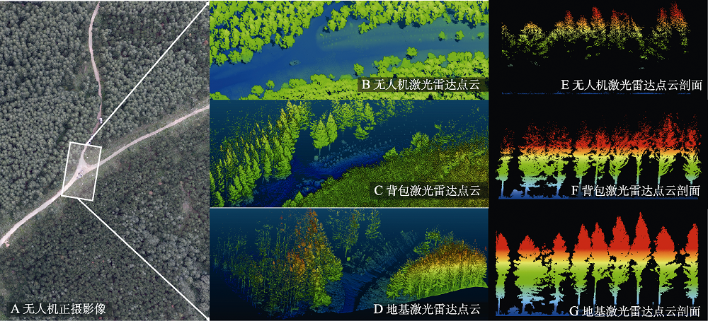
图2. 近地面遥感平台在森林生态系统获取的数据示意图。激光雷达数据中颜色代表高程的高低, 蓝色代表低,红色代表高。
Fig. 2. Image and lidar data of ecosystem monitoring with near-surface remote sensing. A, Aerial image obtained by drone. B, Lidar data acquired by drone. C, Lidar data acquired by backpack. D, Lidar data acquired by terrestrial laser scanner. E, F, G, Profile of pervious three lidar data. The color of lidar data represent the information of elevation, blue is low and red is high.