青藏高原高寒草地: 格局与过程
孙建1,2,3,*( ), 刘国华2,3
), 刘国华2,3
Alpine grassland on the Qingzang Plateau: pattern and process
SUN Jian1,2,3,*(), LIU Guo-Hua2,3
), LIU Guo-Hua2,3
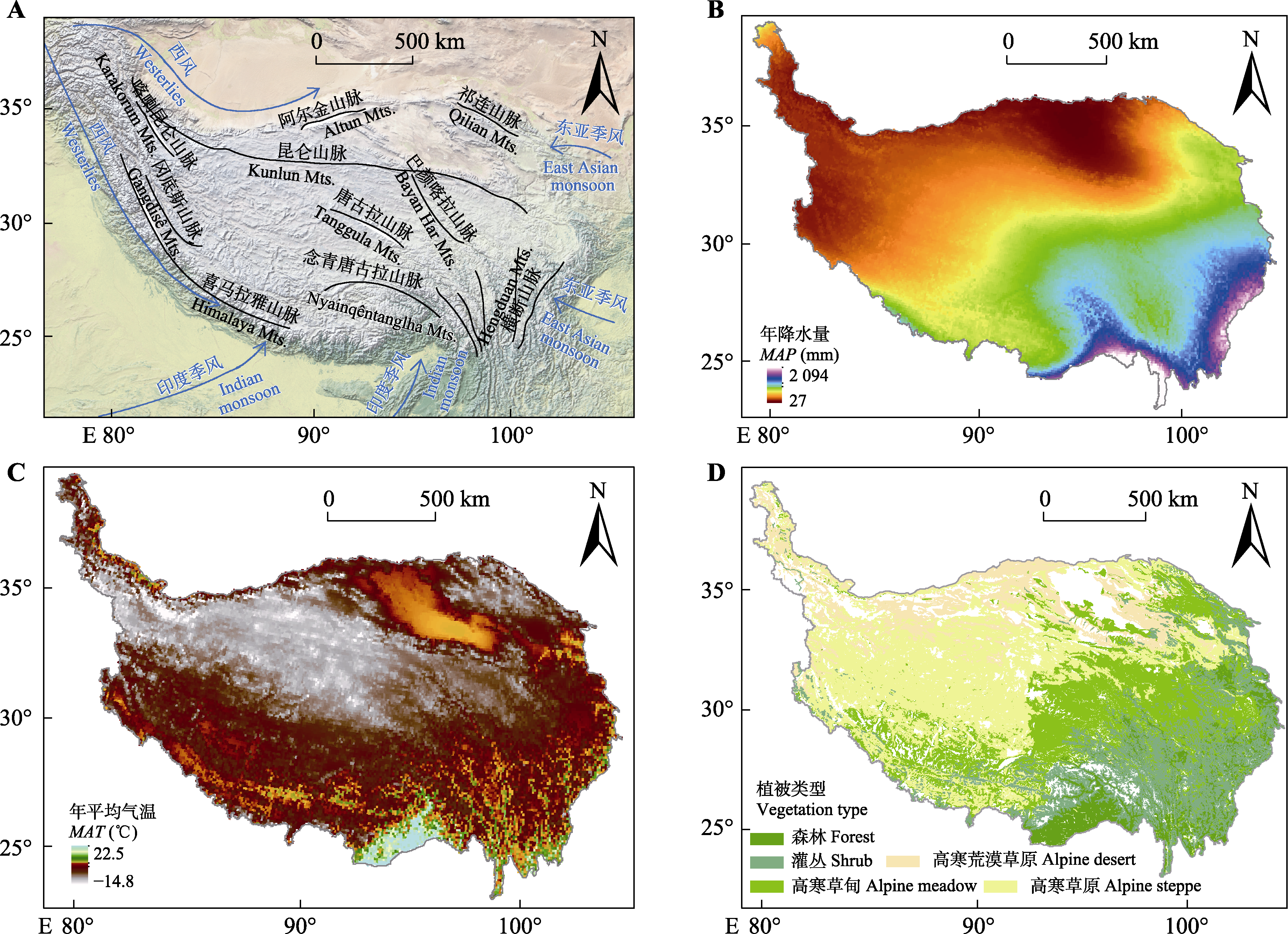
图1. 青藏高原季风与主要山脉格局(A)、年降水量(B)、年平均气温(C)和植被类型地理格局(D)。
Fig. 1. Pattern of monsoon and main mountains (A), mean annual precipitation (MAP)(B), mean annual air temperature (MAT)(C), geographical pattern of vegetation types (D) on the Qingzang Plateau.