基于Sentinel-2数据的草地植物功能多样性遥感反演及其与生产力的关系
赵晏平1, 王忠武1, 温都日根3, 赵玉金2,*( ), 白永飞2,*()
), 白永飞2,*()
Remotely sensed monitoring method of grassland plant functional diversity and its relationship with productivity based on Sentinel-2 satellite data
ZHAO Yan-Ping1, WANG Zhong-Wu1, WENDU Rigen3, ZHAO Yu-Jin2,*(), BAI Yong-Fei2,*()
), BAI Yong-Fei2,*()
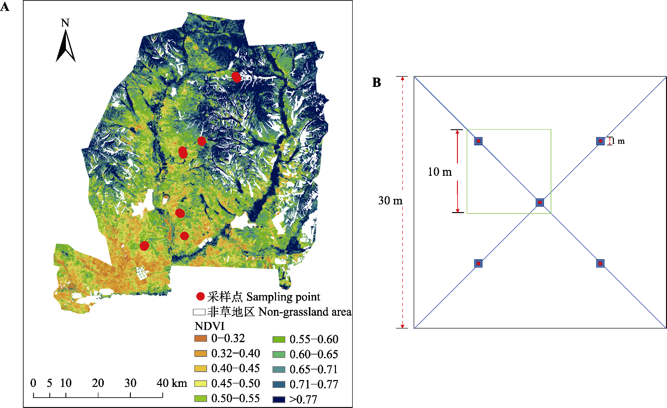
图1. 内蒙古锡林郭勒盟乌拉盖管理区草甸草原研究区采样点位置(A)及样方布设示意图(B)。B中蓝色框为1 m × 1 m小样方; 红色框为小样方中心1/4的面积; 绿色框为10 m × 10 m样方组成方式。NDVI, 归一化植被指数。
Fig. 1. Location of the study area (A) and sample settings (B) across the meadow steppe in the Ulgai Management Area of Xilin Gol League in Nei Mongol. In B, blue boxes represent 1 m × 1 m small sample squares, red boxes represent the area of 1/4 of the center of small sample squares, and the green box represents the composition of 10 m × 10 m sample square. NDVI, normalized difference vegetation index.