卫星遥感监测产品在中国森林生态系统的验证和不确定性分析——基于海量无人机激光雷达数据
刘兵兵1,2, 魏建新1,2,3,*( ), 胡天宇4,5, 杨秋丽4,5, 刘小强4,5, 吴发云6, 苏艳军4,5, 郭庆华7
), 胡天宇4,5, 杨秋丽4,5, 刘小强4,5, 吴发云6, 苏艳军4,5, 郭庆华7
Validation and uncertainty analysis of satellite remote sensing products for monitoring China’s forest ecosystems—Based on massive UAV LiDAR data
LIU Bing-Bing1,2, WEI Jian-Xin1,2,3,*(), HU Tian-Yu4,5, YANG Qiu-Li4,5, LIU Xiao-Qiang4,5, WU Fa-Yun6, SU Yan-Jun4,5, GUO Qing-Hua7
), HU Tian-Yu4,5, YANG Qiu-Li4,5, LIU Xiao-Qiang4,5, WU Fa-Yun6, SU Yan-Jun4,5, GUO Qing-Hua7
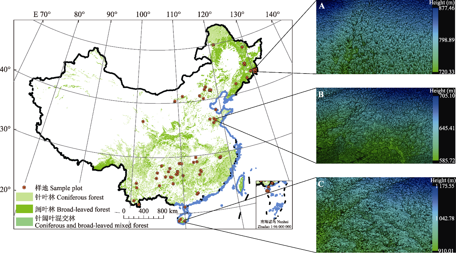
图1. 无人机激光雷达数据采集样地分布以及按高程渲染的三维点云示例图。A, 吉林省塔子沟林场。B, 山东省天麻林场。C, 海南省吊罗山国家森林公园。
Fig. 1. Spatial distribution of unmanned aerial vehicle (UAV) LiDAR data used in this study, and examples of 3D point cloud rendered by elevation. A, Tazigou Forest Farm, Jilin Province. B, Tianma Forest Farm, Shandong Province. C, Diaoluo Mountain National Forest Park, Hainan Province.