卫星遥感监测产品在中国森林生态系统的验证和不确定性分析——基于海量无人机激光雷达数据
刘兵兵1,2, 魏建新1,2,3,*( ), 胡天宇4,5, 杨秋丽4,5, 刘小强4,5, 吴发云6, 苏艳军4,5, 郭庆华7
), 胡天宇4,5, 杨秋丽4,5, 刘小强4,5, 吴发云6, 苏艳军4,5, 郭庆华7
Validation and uncertainty analysis of satellite remote sensing products for monitoring China’s forest ecosystems—Based on massive UAV LiDAR data
LIU Bing-Bing1,2, WEI Jian-Xin1,2,3,*(), HU Tian-Yu4,5, YANG Qiu-Li4,5, LIU Xiao-Qiang4,5, WU Fa-Yun6, SU Yan-Jun4,5, GUO Qing-Hua7
), HU Tian-Yu4,5, YANG Qiu-Li4,5, LIU Xiao-Qiang4,5, WU Fa-Yun6, SU Yan-Jun4,5, GUO Qing-Hua7
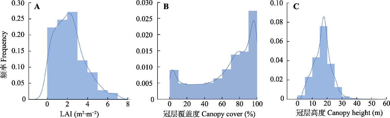
图2. 无人机激光雷达获取的3个森林结构参数分布直方图。
Fig. 2. Histograms of three forest structural attributes derived from unmanned aerial vehicle (UAV) LiDAR data. LAI, leaf area index.