)
)
)
)
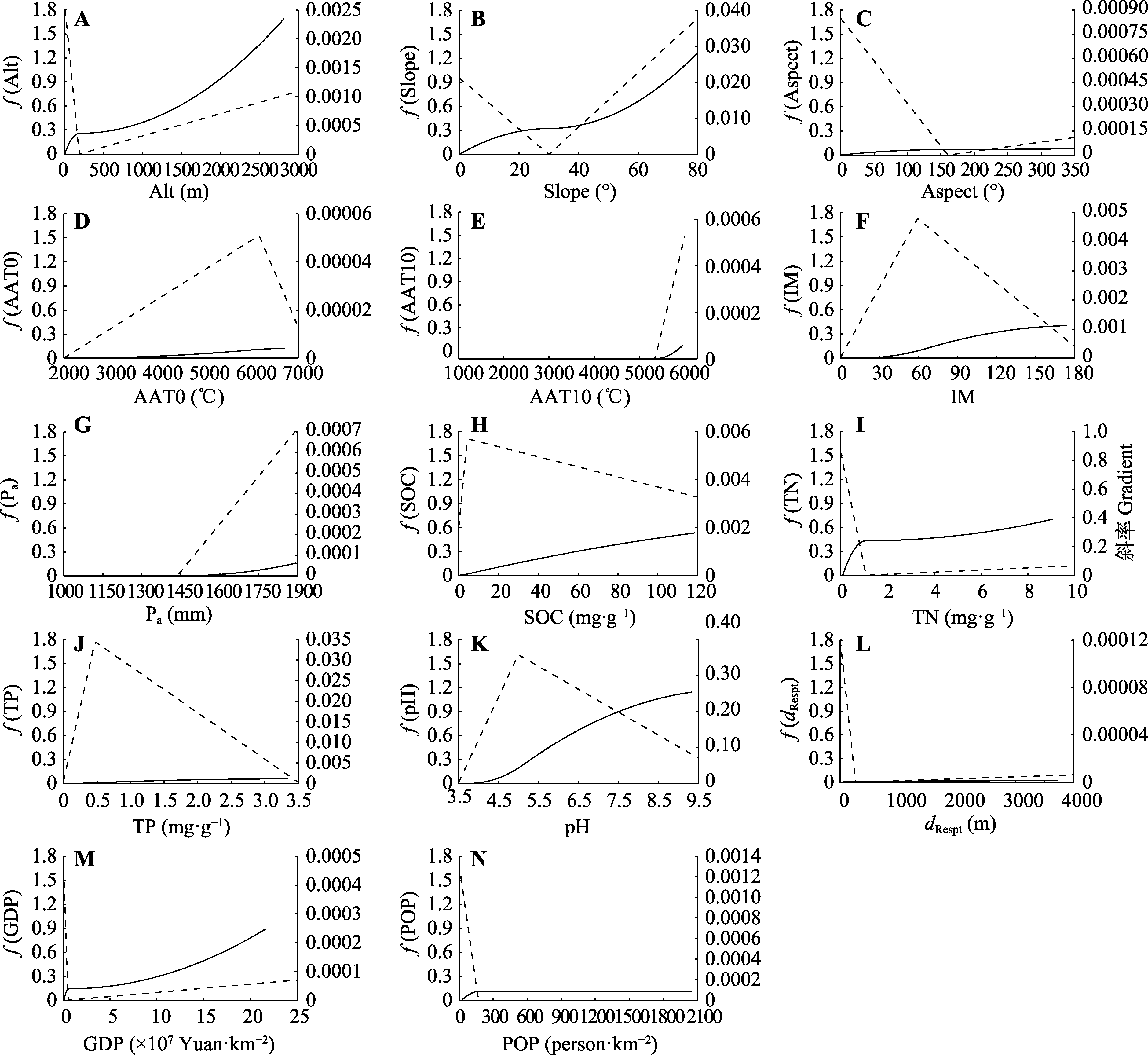
图2. 中国中亚热带北部灌丛地形变量(A-C)、气候分异(D-G)、土壤理化性质(H-K)、人为干扰(L-N)与植物群落β多样性的关系。AAT0, ≥0 ℃积温; AAT10, ≥10 ℃积温; Alt, 海拔; Aspect, 坡向; dRespt, 距居民点的距离; GDP, 国内生产总值; IM, 湿润指数; Pa, 年降水量; POP, 人口空间分布; Slope, 坡度; SOC, 土壤有机碳含量; TN, 土壤总氮含量; TP, 土壤总磷含量。实线为偏响应曲线, 虚线为偏响应曲线的变化斜率, y轴f (变量)指示I-spline转换函数, 单位为群落相异性连接单位-ln(1 - dij), 其中dij指站点i和j之间的相异性。
Fig. 2. Relationship between the gradient of topographic variables (A-C), climate variables (D-G), soil physical and chemical properties (H-K), human disturbance (L-N) and β diversity of shrubland communities in northern mid-subtropical China. AAT0, accumulated temperature (≥0 °C); AAT10, accumulated temperature (≥10 °C); Alt, altitude; dRespt, distance to resident; GDP, gross domestic product; IM, moisture index; Pa, mean annual precipitation; POP, population spatial distribution; SOC, soil organic carbon content; TN, soil total nitrogen content; TP, soil total phosphorus content. Solid line is the partial response curve, and the dashed line is the change slope of the partial response curve. The function f (variable) in y axis indicated the I-spline-transformed function, and its unit was linking unit of community dissimilarity -ln(1 - dij), dij represents the dissimilarity between sites i and j.