基于高精度遥感影像和精细植被踏查的金华北山植被制图
- 1浙江师范大学生命科学学院, 浙江金华 321004
2浙江金华山亚热带森林生态系统野外科学观测研究站, 浙江金华 321004
收稿日期: 2023-12-11
录用日期: 2024-09-28
网络出版日期: 2024-09-29
基金资助
国家自然科学基金(31870462)
Vegetation mapping of Beishan Mountain in Jinhua, Zhejiang, based on high-resolution remote sensing image and intensive vegetation survey
- 1College of Life Sciences, Zhejiang Normal University, Jinhua, Zhejiang 321004, China
2Jinhua Mountain Observation and Research Station for Subtropical Forest Ecosystems, Jinhua, Zhejiang 321004, China
Received date: 2023-12-11
Accepted date: 2024-09-28
Online published: 2024-09-29
Supported by
National Natural Science Foundation of China(31870462)
摘要
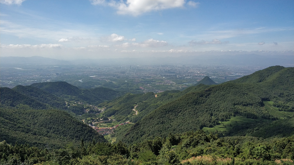
植被图展示一个地区的植被类型及其空间分布格局, 是研究植被和生物多样性等基础生态学, 以及植被恢复和管理等应用生态学的重要依据。以中亚热带常绿阔叶林区域的浙江省金华北山为研究对象, 基于高分二号(GF-2)高精度遥感图像, 结合大批量野外植被调查, 利用地理信息系统(ArcGIS)和遥感图像处理软件(ENVI)制作了金华北山1:6万高精度现状植被图。结果表明: 1)高精度遥感图像和大批量植被记录相结合, 较好刻画了金华北山南坡的植被格局, 共划分为7个植被型组、22个植被型、25个植被亚型、60个群系组和76个群系。2)在金华北山南坡65.5 km2区域内, 植被覆盖率约为93.0%, 且以森林(66.1%)、农业植被(14.7%)和灌丛(10.5%)为主。3)分布于海拔900 m以下、面积为10.6 km2的马尾松(Pinus massoniana)林, 分布于海拔108-946 m之间、面积为7.4 km2的马尾松-落叶阔叶混交林, 以及分布于海拔100-1 037 m之间、面积为5.3 km2的木荷(Schima superba)林, 是分布范围最大的3类群系。该研究是大比例尺局域植被制图的一个案例, 能够为不同比例尺区域和全国高精度植被制图、植被生态学研究和植被经营管理提供基础资料。
本文引用格式
郑亚纹 , 樊海东 , 刘立斌 , 倪健 . 基于高精度遥感影像和精细植被踏查的金华北山植被制图[J]. 植物生态学报, 2024 , 48(11) : 1471 -1485 . DOI: 10.17521/cjpe.2023.0371
Abstract
Aims Vegetation map illustrates the vegetation types and their spatial distribution patterns of a given area, which is an important foundation for investigating fundamental ecology such as vegetation feature and biodiversity study, as well as applied ecology such as vegetation restoration and management. The aim of this research is to chart a high-resolution local vegetation map of Beishan Mountain in Jinhua, Zhejiang Province, a middle subtropical evergreen broadleaf forest region in eastern China.
Methods A digital vegetation map with very high spatial resolution at the 1:60 000 scale in a 65.5 km² area in the middle part of the southern slope of Beishan Mountain in Jinhua was produced, based on high-resolution of 1-4 m satellite (GF-2) remote sensing images and intensive field vegetation surveys of 3 774 sites and 24 plots. The Geographical Information System (ArcGIS) and remote sensing image processing software (ENVI) were further utilized to conduct the mapping.
Important findings 1) High-resolution remote sensing images and a large quantity of vegetation records characterized the vegetation pattern on the southern slope of Beishan Mountain in Jinhua. The vegetation was divided into 7 Vegetation Formation Groups, 22 Vegetation Formations, 25 Vegetation Subformations, 60 Alliance Groups, and 76 Alliances. 2) In the 65.5 km2area on the southern slope of Beishan Mountain in Jinhua, the vegetation coverage of mapping area is about 93.0%. Among these vegetation areas, forest (66.1%), agricultural vegetation (14.7%) and shrubland (10.5%) are the main three vegetation types. 3) The three widely distributed alliances are Pinus massoniana forest in an area of 10.6 km2 and distributed below 900 m in altitude, Pinus massoniana - deciduous broadleaf mixed forest in an area of 7.4 km2 and distributed between 108 and 946 m, and Schima superba forest in an area of 5.3 km2 and distributed in 100-1 037 m. This is a case study of vegetation mapping at a big mapping scale. Such study can provide fundamental data for the high-resolution regional and national vegetation mappings at multiple scales, research of vegetation science, and vegetation service and management.
参考文献
| [1] | de Colstoun ECB, Story MH, Thompson C, Commisso K, Smith TG, Irons JR (2003). National Park vegetation mapping using multitemporal Landsat 7 data and a decision tree classifier. Remote Sensing of Environment, 85, 316-327. |
| [2] | Deng MD (2022). Vegetation Classification and 1:50000 Vegetation Map Drawing in the Ecological “Green-Core” Area of Changzhutan Urban Cluster. Master degree dissertation, Central South University of Forestry & Technology, Changsha. |
| [邓梦达 (2022). 长株潭绿心区植被分类及1: 50000植被图绘制. 硕士学位论文, 中南林业科技大学, 长沙.] | |
| [3] | Deng SB, Chen QJ, Du HJ, Xu EH (2014). ENVI Method of Remote Sensing Image Processing. 2nd ed. Higher Education Press, Beijing. 60-67, 132-150. |
| [邓书斌, 陈秋锦, 杜会建, 徐恩惠 (2014). ENVI遥感图像处理方法. 2版. 高等教育出版社, 北京. 60-67, 132-150.] | |
| [4] | Fan HD, Chen HY, Wu YN, Liu JF, Xu DY, Cao JY, Yuan Q, Tan B, Liu XT, Xu J, Wang GM, Han WJ, Liu LB, Ni J (2019). Community characteristics of main vegetation types on the southern slope of Beishan Mountain in Jinhua, Zhejiang, China. Chinese Journal of Plant Ecology, 43, 921-928. |
| [樊海东, 陈海燕, 吴雁南, 刘建峰, 徐德宇, 曹嘉瑜, 袁泉, 谭斌, 刘晓彤, 徐佳, 王国敏, 韩文娟, 刘立斌, 倪健 (2019). 金华北山南坡主要植被类型的群落特征. 植物生态学报, 43, 921-928.] | |
| [5] | Fang JY, Guo K, Wang GH, Tang ZY, Xie ZQ, Shen ZH, Wang RQ, Qiang S, Liang CZ, Da LJ, Yu D (2020). Vegetation classification system and classification of vegetation types used for the compilation of vegetation of China. Chinese Journal of Plant Ecology, 44, 96-110. |
| [方精云, 郭柯, 王国宏, 唐志尧, 谢宗强, 沈泽昊, 王仁卿, 强胜, 梁存柱, 达良俊, 于丹 (2020). 《中国植被志》的植被分类系统、植被类型划分及编排体系. 植物生态学报, 44, 96-110.] | |
| [6] | Guo K, Fang JY, Wang GH, Tang ZY, Xie ZQ, Shen ZH, Wang RQ, Qiang S, Liang CZ, Da LJ, Yu D (2020). A revised scheme of vegetation classification system of China. Chinese Journal of Plant Ecology, 44, 111-127. |
| [郭柯, 方精云, 王国宏, 唐志尧, 谢宗强, 沈泽昊, 王仁卿, 强胜, 梁存柱, 达良俊, 于丹 (2020). 中国植被分类系统修订方案. 植物生态学报, 44, 111-127.] | |
| [7] | Guo QH, Guan HC, Hu TY, Jin SC, Su YJ, Wang XJ, Wei DJ, Ma Q, Sun QH (2021). Remote sensing-based mapping for the new generation of Vegetation Map of China (1:500,000). Scientia Sinica (Vitae), 51, 229-241. |
| [郭庆华, 关宏灿, 胡天宇, 金时超, 苏艳军, 王雪静, 魏邓杰, 马勤, 孙千惠 (2021). 新一代1:50万中国植被图绘制方法探讨. 中国科学: 生命科学, 51, 229-241.] | |
| [8] | Guo YF, Wu TJ, Luo JC, Shi HN, Gao LJ (2022). Remote sensing mapping of mountain vegetation via uncertainty-based iterative optimization. Journal of Geo-Information Science, 24, 1406-1419. |
| [郭逸飞, 吴田军, 骆剑承, 石含宁, 郜丽静 (2022). 基于不确定性迭代优化的山地植被遥感制图. 地球信息科学学报, 24, 1406-1419.] | |
| [9] | Hou XY (1960). China’s Vegetation. People’s Education Press, Beijing. |
| [侯学煜 (1960). 中国的植被. 人民教育出版社, 北京.] | |
| [10] | Hou XY (2001). Vegetation Atlas of China (1:1000000). Science Press, Beijing. |
| [侯学煜 (2001). 1:1000000 中国植被图集. 科学出版社, 北京.] | |
| [11] | Hou XY, Ma RZ (1956). Wall Map of Vegetation-Soil Regionalization in China (1:4000000). Map Publishing House, Beijing. |
| [侯学煜, 马溶之 (1956). 中国植被-土壤分区挂图(1: 400万). 地图出版社, 北京.] | |
| [12] | Hou XY, Sun SZ, Zhang JW, He MG, Wang YF, Sun DZ, Wang SQ (1979). Vegetation Map of the People’s Republic of China (1:4000000). Map Publishing House, Beijing. |
| [侯学煜, 孙世洲, 张经炜, 何妙光, 王义风, 孙德珍, 王绍庆 (1979). 中华人民共和国植被图(1: 4000000). 地图出版社, 北京.] | |
| [13] | Institute of Botany, Chinese Academy of Sciences(1980). Application of remote sensing method in vegetation mapping. Agricultural Regional Planning, (3), 44-50. |
| [中国科学院植物研究所 (1980). 遥感方法在植被制图中的应用. 农业区划, (3), 44-50.] | |
| [14] | Jia NX, Guo K, Song CY, Liu CC (2021). Principles of color and symbol design for vegetation mapping and a scheme of national vegetation map legends. Chinese Journal of Plant Ecology, 45, 809-817. |
| [贾宁霞, 郭柯, 宋创业, 刘长成 (2021). 植被制图色彩和符号设计原则与全国植被图图例方案. 植物生态学报, 45, 809-817.] | |
| [15] | Ma KP, Guo QH (2021). Progress and recent trends of vegetation ecology in China. Scientia Sinica (Vitae), 51, 215-218. |
| [马克平, 郭庆华 (2021). 中国植被生态学研究的进展和趋势. 中国科学: 生命科学, 51, 215-218.] | |
| [16] | Malan OG, Westfall RH (1987). A new strategy for vegetation mapping with the aid of Landsat MSS data. Advances in Space Research, 7, 97-103. |
| [17] | Rodriguez-Galiano VF, Chica-Olmo M, Abarca-Hernandez F, Atkinson PM, Jeganathan C (2012). Random Forest classification of Mediterranean land cover using multi-seasonal imagery and multi-seasonal texture. Remote Sensing of Environment, 121, 93-107. |
| [18] | Sang JW, Song CY, Jia NX, Jia Y, Liu CC, Qiao XG, Zhang L, Yuan WY, Wu DX, Li LH, Guo K (2023). Vegetation survey and mapping on the Qinghai-Tibet Plateau. Biodiversity Science, 31, 22430. DOI: 10.17520/biods. 2022430. |
| [桑佳文, 宋创业, 贾宁霞, 贾元, 刘长成, 乔鲜果, 张琳, 袁伟影, 吴冬秀, 李凌浩, 郭柯 (2023). 青藏高原植被调查与制图评估. 生物多样性, 31, 22430. DOI: 10.17520/biods.2022430.] | |
| [19] | Shi JX (2021). Vegetation Classification and Mapping of Zhoushan Archipelago. Master degree dissertation, East China Normal University, Shanghai. |
| [石娇星 (2021). 舟山群岛植被分类与制图. 硕士学位论文, 华东师范大学, 上海.] | |
| [20] | Song YC (2004). Tentative classification scheme of evergreen broad-leaved forests of China. Acta Phytoecologica Sinica, 28, 435-448. |
| [宋永昌 (2004). 中国常绿阔叶林分类试行方案. 植物生态学报, 28, 435-448.] | |
| [21] | Song YC (2013). Evergreen Broad-leaved Forests in China: Classification, Ecology, Conservation. Science Press, Beijing. |
| [宋永昌 (2013). 中国常绿阔叶林: 分类·生态·保育. 科学出版社, 北京.] | |
| [22] | Song YC (2017). Vegetation Ecology. 2nd ed. Higher Education Press, Beijing. |
| [宋永昌 (2017). 植被生态学. 2版. 高等教育出版社, 北京.] | |
| [23] | Su YJ, Guo QH, Hu TY, Guan HC, Jin SC, An SZ, Chen XL, Guo K, Hao ZQ, Hu YM, Huang YM, Jiang MX, Li JX, Li ZJ, Li XK, et al. (2020). An updated vegetation map of China (1:1000000). Science Bulletin, 65, 1125-1136. |
| [24] | Sun XH, Shi JK, Li XW, Wu WJ, Liang L, Gong C (2021). Mapping and dynamic changes of refined vegetation distribution in Xisha Islands. National Remote Sensing Bulletin, 25, 1473-1488. |
| [孙晓慧, 史建康, 李新武, 吴文瑾, 梁雷, 宫晨 (2021). 西沙群岛精细植被分布的遥感制图及动态变化. 遥感学报, 25, 1473-1488.] | |
| [25] | The Editorial Committee of Vegetation Map of China, Chinese Academy of Sciences(2007). Vegetation Map of the People’s Republic of China 1:1000000. Geological Publishing House, Beijing. |
| [中国科学院中国植被图编辑委员会 (2007). 中华人民共和国植被图1:1000000. 地质出版社, 北京.] | |
| [26] | The Editorial Committee of Vegetation of China (1980). Vegetation of China. Science Press, Beijing. |
| [中国植被编辑委员会 (1980). 中国植被. 科学出版社, 北京.] | |
| [27] | Tian LS (1993). Vegetation Mapping. Xi’an Map Press, Xi’an. |
| [田连恕 (1993). 植被制图. 西安地图出版社, 西安.] | |
| [28] | Wang H, Wang CB, Wu HG (2016). Using GF-2 imagery and the conditional random field model for urban forest cover mapping. Remote Sensing Letters, 7, 378-387. |
| [29] | Wang L, Dong L, Hu TY, Guo K (2021a). History and prospect of vegetation map compilation in China. Scientia Sinica (Vitae), 51, 219-228. |
| [王乐, 董雷, 胡天宇, 郭柯 (2021a). 中国植被图编研历史与展望. 中国科学: 生命科学, 51, 219-228.] | |
| [30] | Wang L, Dong L, Zhao ZP, Lu SZ, Wang J, Liu YG, Jin SC, Guan HC, Guo K (2021b). Vegetation diversity and mapping in the priority area of Taihang Mountains biodiversity conservation (Beijing-Tianjin-Hebei region). Scientia Sinica (Vitae), 51, 289-299. |
| [王乐, 董雷, 赵志平, 陆帅志, 王静, 刘永刚, 金时超, 关宏灿, 郭柯 (2021b). 太行山生物多样性保护优先区域京津冀地区植被多样性与植被制图. 中国科学: 生命科学, 51, 289-299.] | |
| [31] | Xie YC, Sha ZY, Yu M (2008). Remote sensing imagery in vegetation mapping: a review. Journal of Plant Ecology, 1, 9-23. |
| [32] | Xu MS, Zhu XT, Wang WS, Du YC, Wang YY, Liang QM, Zheng LT, Yan ER (2022). Vegetation classification and mapping of Dajinshan Island: a grid inventory-based approach. Guihaia, 42, 1273-1283. |
| [许洺山, 朱晓彤, 王万胜, 杜运才, 汪彦颖, 梁启明, 郑丽婷, 阎恩荣 (2022). 上海大金山岛植被分类与制图——基于网格化清查方法. 广西植物, 42, 1273-1283.] | |
| [33] | Yao YH, Zhang JY, Suonan DZ (2020). Compilation of 1:50000 vegetation type map with remote sensing images based on mountain altitudinal belts of Taibai Mountain in the north-south transitional zone of China. Acta Geographica Sinica, 75, 620-630. |
| [姚永慧, 张俊瑶, 索南东主 (2020). 南北过渡带1:5万植被类型图遥感制图案例研究. 地理学报, 75, 620-630.] | |
| [34] | Ying XF, Liu P, Guo SL, Chen JH, Lu HF (2006). Study on the woody plant flora of Beishan Mount of Jinhua in Zhejiang Province. Journal of Shanghai Jiaotong University (Agricultural Science), 24, 39-43. |
| [应小芳, 刘鹏, 郭水良, 陈建华, 吕洪飞 (2006). 浙江金华北山木本植物区系研究. 上海交通大学学报(农业科学版), 24, 39-43.] | |
| [35] | Zhang H, Zhao CL, Zhu WQ (2021). A new vegetation map for Qinghai-Tibet Plateau by integrated classification from multi-source data products. Journal of Beijing Normal University (Natural Science), 57, 816-824. |
| [张慧, 赵涔良, 朱文泉 (2021). 基于多源数据产品集成分类制作的青藏高原现状植被图. 北京师范大学学报(自然科学版), 57, 816-824.] | |
| [36] | Zhang XL, Zhou JH, Cai WT, Gao NN, Zheng YR (2018). Vegetation mapping (1:100000) in Heihe River Basin using 3S technology. Journal of Northwest Normal University (Natural Science), 54(2), 95-101. |
| [张晓龙, 周继华, 蔡文涛, 高楠楠, 郑元润 (2018). 基于3S技术的黑河流域1:100000植被制图. 西北师范大学学报(自然科学版), 54(2), 95-101.] |